E-Bike & Climb -
Nauders - Tyrolean Oberland - Kaunertal -
Ice Climbing
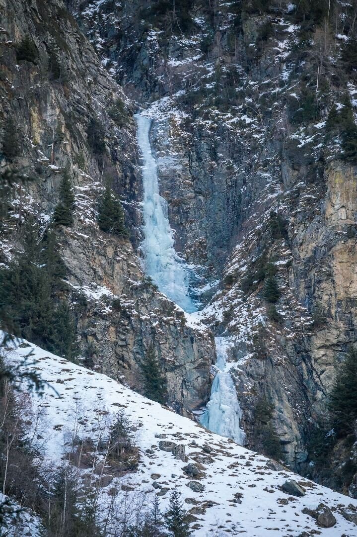
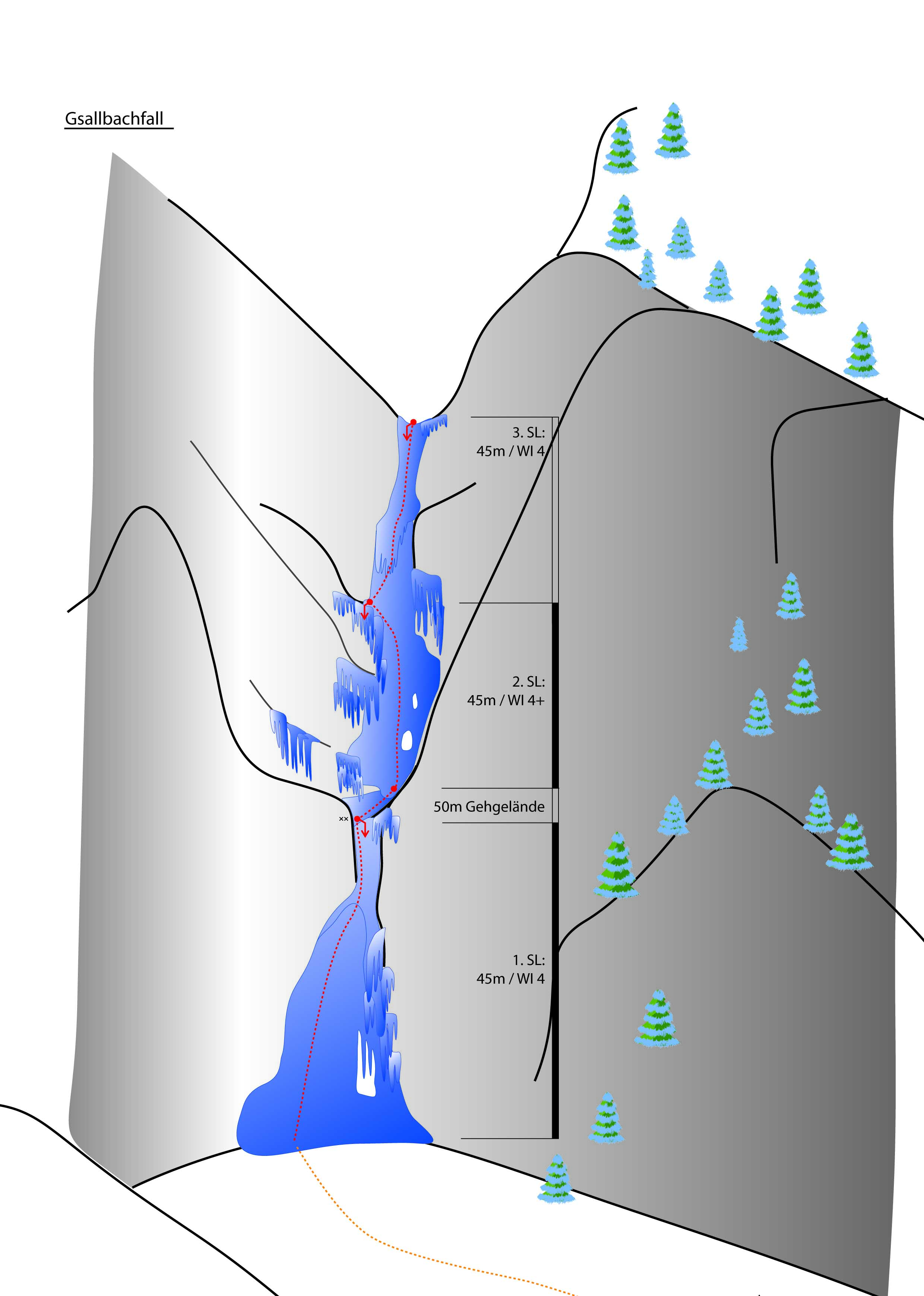
Gsallbachfall - Kaunertal
Difficulty
WI 4+
Sea Level
1400 - 180 m
Route length
-1220 m
Number of routes
1
GPS Position / Ascent
All real-time data of the infrastructures can be found in the
fullscreen view of the interactive map
Beautiful waterfall embedded in an impressive canyon.
Approach: Parking lot by a right-hand bend ca. 300 m before the hamlet of Vergötschen.
Ascent: Follow the ride shoulder on the orographic right side of the Gsallbach brook to the foot of the waterfall. (15 min)
Descent: The two lower levels are equipped with abseiling belays. If you clomb the entire waterfall, we recommend you taking the hiking trail towards Gsallalm back. (appr. 1 h)
Caution: A large icicle often forms on the second-last level (20 m) due to the direct sunlight from the west please proceed with caution when the sun is shining! Also very high avalanche risk in the spring.
Journey
Anreise per Auto:
Wenn Sie aus Norden kommen...
A7 Füssen/Garmisch - B 179 Fernpass - Imst A 12 - Landeck/Zams - Landecker Tunnel B 180 - Prutz - Kaunertal
Wenn Sie von Westen kommen...
Bregenz A14- Arlberg (Tunnel oder Pass) S16 - Landeck - Landecker Tunnel B 180 - Prutz - Kaunertal
Wenn Sie von Süden kommen...
Reschenpass - Nauders B180 - Pfunds - Prutz - Kaunertal
Wenn Sie von Osten kommen...
Wien - A12 - Innsbruck - Landeck/Zams - Landecker Tunnel - B 180 Prutz - Kaunertal
Anreise per Zug/Bus:
Bahnhof Landeck/Zams - von dort mit dem Bus nach Prutz Innbrücke - von da dann mit der Linie 4232 dem Bus zur Haltestelle Kaunertal Platz. Fahrzeiten bitte beachten!
Parking
Parkplatz bei einer leichten Rechtskurve ca. 300 m vor dem Weiler Vergötschen