Ehnbachklamm
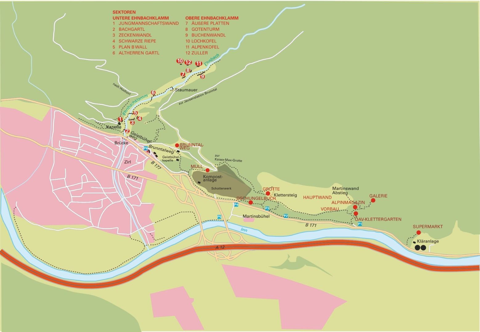
The rather large climbing area of the Ehnbachklamm gorge is divided into several sectors of varying degrees of difficulty and rock structures and is divided into the lower and upper Ehnbachklamm. In total there are about 130 rehabilitated routes, which are oriented in all directions. The climbing is mostly done on small ledges and holes.
CAUTION:
The sectors Zuller west, south, east and north side, Lochkofel, Matterhorn, Altherrengartl, Plan B Wall, Schwarze Riepe and Alpenkofel are not renovated and should be approached with extreme caution!
There are several ways to get into the Ehnbachklamm:
If you are coming from the motorway, exit at Zirl- Ost and follow the Bunderstraße B171 in the direction of Zirl. Immediately after entering Zirl, you can see an M-price (supermarket) on the right hand side pass this supermarket, and after a petrol station turn sharp right into Geistbühelweg, Ehnbachweg, follow this road through the underpass until you reach a rescue organisation (Red Cross). Behind this building you can park without any problems.
It is also possible coming from the motorway in the direction of Seefeld B177, E533 immediately after reaching this road there is an exit on the right hand side directly to the Red Cross. (Caution very confusing)
From here on foot to the Ehnbachklamm - depending on the sector 10 to 30 minutes walking time.